Gulberwick Geology
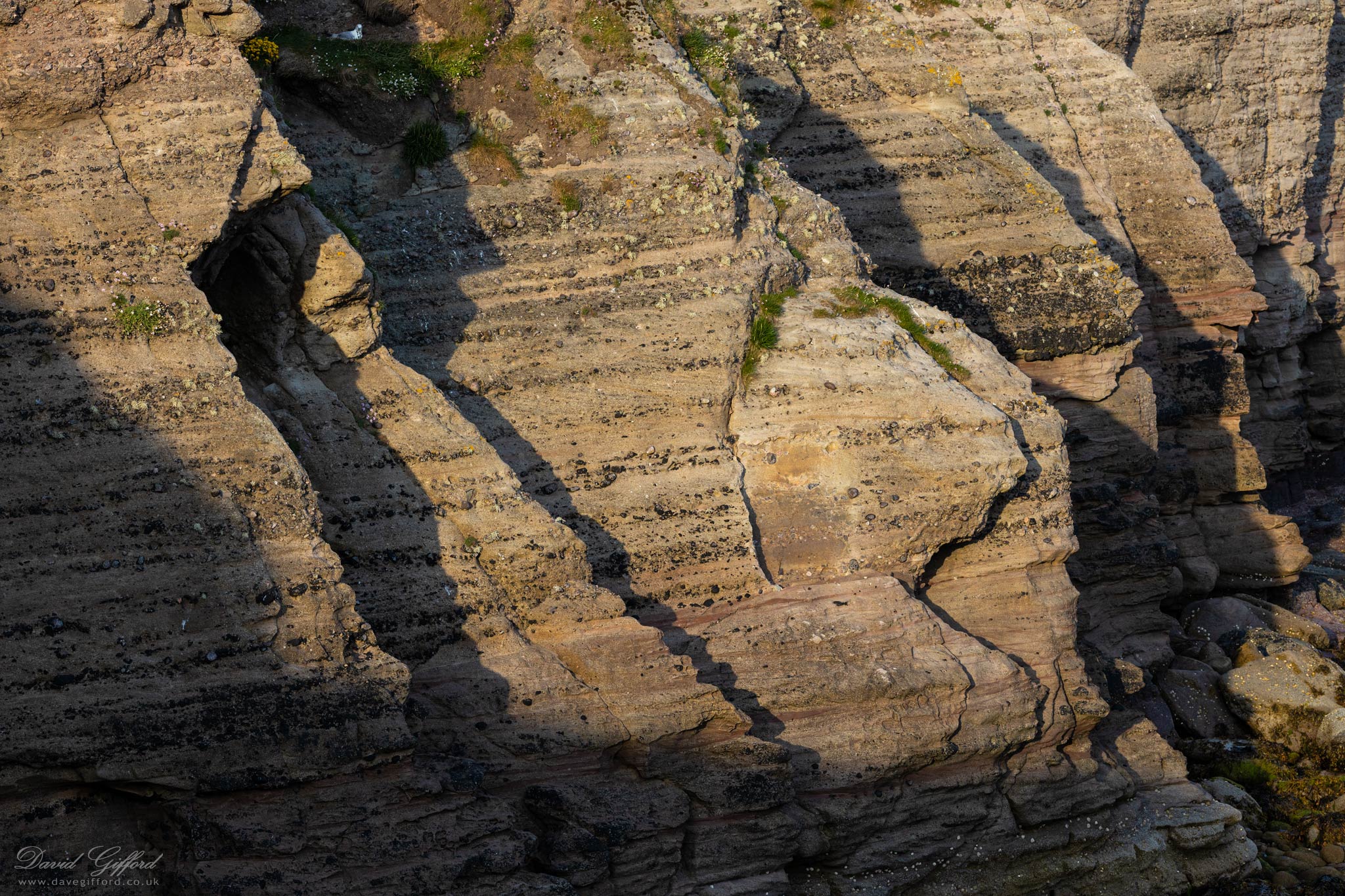
Millions of years of history to be read in the exposed Devonion period sandstone near Gulberwick beach.
Wanting to find out more about the geology, I happened on the very same scene on the Shetland Landscapes website [Edit - link no longer available].
The site explains:
“Around 370 million years ago a walk through where Lerwick is now would have meant a wade across fast flowing rivers in a climate not unlike the Death Valley of today. These rivers were fed by run off from high mountains to the west and carried sediments east to be deposited in lakes. The cobbles, gravels and sands of these rivers can be best seen at Gulberwick […]” [Shetland Landscapes - Geology of Shetland]
And gives the following caption for the Gulberwick locale:
“The medium to very coarse sandstone displaying trough and planar cross bedding above channel lag pebbles were laid down in active channels of braided streams. Fine grained red siltstones and mudstones with desiccation cracks are overbank deposits from flood events. Thicker beds of fine-grained sandstone formed from suspension in abandoned channels.” [Shetland Landscapes - Devonian of SE Shetland]
This description didn’t mean much to me on a first-reading! I think I’ve got the gist of it now, with the help of a makeshift glossary (extracts from Wikipedia):
Sandstone - A clastic sedimentary rock composed mainly of sand-sized mineral particles or rock fragments (clasts) or organic material.
Cross-bedding - Layering within a stratum and at an angle to the main bedding plane. The sedimentary structures which result are roughly horizontal units composed of inclined layers. The original depositional layering is tilted, such tilting not being the result of post-depositional deformation.
Trough and planar cross bedding - Cross-bedding can be subdivided according to geometry. The most commonly described types are tabular cross-bedding and trough cross-bedding. Tabular cross-bedding, or planar bedding consists of cross-bedded units that are extensive horizontally relative to the set thickness and that have essentially planar bounding surfaces. Trough cross-bedding, on the other hand, consists of cross-bedded units in which the bounding surfaces are curved, and hence limited in horizontal extent.
Lag deposit - The deposition of material winnowed by physical action.
Braided channel - A braided river, or braided channel, consists of a network of river channels separated by small, often temporary, islands called braid bars. Braided streams tend to occur in rivers with high sediment loads and/or coarse grain sizes, and in rivers with steeper slopes than typical rivers with straight or meandering channel patterns. They are also associated with rivers with rapid and frequent variation in the amount of water they carry.
Siltstone - A sedimentary rock that has a grain size in the silt range, finer than sandstone and coarser than claystones. It is differentiated from shale by having majority silt, not clay.
Silt - A granular material of a size between sand and clay, whose mineral origin is quartz and feldspar.
Mudstone - A type of mudrock, mudstone is a fine-grained sedimentary rock whose original constituents were clays or muds. Grain size is up to 0.063 millimetres (0.0025 in) with individual grains too small to be distinguished without a microscope.
Clay - A type of fine-grained natural soil material that contains hydrous aluminium phyllosilicates (clay minerals) that develops plasticity when wet.
Desiccation - The state of extreme dryness, or the process of extreme drying.
Overbank - An alluvial geological deposit consisting of sediment that has been deposited on the floodplain of a river or stream by flood waters that have broken through or overtopped the banks.
Alluvium - Loose, unconsolidated (not cemented together into a solid rock) soil or sediment that has been eroded, reshaped by water in some form, and redeposited in a non-marine setting.
Suspension - Sedimentation typically occurs by the sand settling out from suspension; i.e., ceasing to be rolled or bounced along the bottom of a body of water or ground surface.
[Gulberwick during Lockdown collection - Image 60 of 80]
Posted:
Image #1118